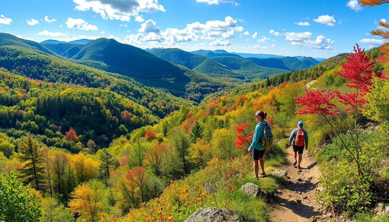
Best Hikes in North Georgia offer a unique mix of breathtaking landscapes and memorable trails. From the challenging ascent of Blood Mountain Loop to the picturesque views along the Tallulah Gorge Sliding Rock Trail, North Georgia presents diverse hiking adventures for all nature enthusiasts.
Blood Mountain Loop: Best Hikes in North Georgia

As one of the best hikes in North Georgia, the Blood Mountain Loop is renowned for its stunning views and challenging terrains. At 4,459 feet, it’s the highest point on the Appalachian Trail in Georgia, offering hikers a journey filled with natural beauty.
Trail Overview and Highlights
Starting at Neels Gap, the trail quickly shows diverse landscapes. You’ll see everything from wide rock outcrops to dense, boulder-packed forests. At 4,459 feet, Blood Mountain is the trail’s peak in Georgia. A historic stone shelter from the 1930s rests at the summit.
This trail is loved for its tough climbs and sweeping views of Georgia’s Appalachians. Fall brings out incredible leaf colors. It mixes busy paths with quiet stretches, offering new experiences with each hike.
What to Expect on the Blood Mountain Loop
The trail climbs steeply, gaining over 1,400 feet from the Byron Reece Trailhead. It’s one of the tougher hikes in North Georgia. You will cross paths with other trails like Duncan Ridge and Slaughter Creek, adding more exploring chances.
The trail winds through rocky areas, forest trails, past streams and rhododendrons. The Freeman Trail part is especially rocky but scenic. With a moderate to difficult rating, come well-prepared with the right gear, like an Osprey day pack.
Dogs on leashes are okay on this trail. But try to start early, especially in the fall, to find parking and enjoy one of North Georgia’s finest hikes.
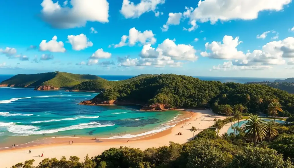
Exploring the Best Hikes in North Georgia: Tallulah Gorge Sliding Rock Trail

Tallulah Gorge State Park hosts some of the best hikes in North Georgia. The Sliding Rock Trail spans around 3.4 miles and offers a mix of stunning views and physical challenges, making it a must-visit trail.
Trail Description and Features
The Sliding Rock Trail provides amazing views of Georgia. It’s seen as moderate to difficult, dropping 500 feet early on. The path includes rocky terrain and a notable suspension bridge over the Tallulah River.
Nearby, you’ll find Bridal Veil Falls, a spot where you can swim up to a natural dam.
The trail needs a gorge floor permit for access. Dogs aren’t allowed to keep the habitat safe and preserve it for visitors.
Read also: Best Hikes in Washington
Permits and Trail Access
Before hitting the trail, get a permit from the park’s ranger office. They limit permits to 100 a day. These run out fast, especially on weekends and in summer. Permits are available until 4 PM in warmer months and 3 PM in colder months.
Remember, permits aren’t given on dam release days. Check the dam release schedule before you go. Entry to the park is $5 per car. For accurate directions, use the Nat Geo 778 Trails Illustrated Map. Here are some key hike details:
| Trail Name | Distance | Description | Permit Required |
|---|---|---|---|
| Sliding Rock Trail | 3.4 miles | Leads to Bridal Veil Falls and features a deep swimming hole | Yes |
| Hurricane Falls Trail | 2.25 miles | Includes a significant stair descent to reach the suspension bridge | No |
| North Rim & South Rim Trails | 2.5 miles | Provides stunning views of Tallulah Falls waterfalls | No |
| Shortline Trail | 2.8 miles | Paved path suitable for running, walking, or biking | No |
Prepare well and start early to make the most of the Tallulah Gorge Sliding Rock Trail. It’s a must-have hike in the Georgia mountains.
Raven Cliff Falls Trail: A Chattahoochee National Forest Gem

Starting your hike on Raven Cliff Falls Trail brings you into the heart of north Georgia’s beauty. This trail is near Helen, Georgia, and is both fun and a bit challenging. It winds through the famous Chattahoochee National Forest, known for its rich birdlife and wildflowers.
The trail stretches for 4.9 miles towards the remarkable Raven Cliff Falls. The falls, with water dropping from 40 feet, are a breathtaking view. The water splits a giant cliff and flows down 400 feet through rocks. This creates a stunning view, especially in spring.
The path to Raven Cliff Falls is a journey of moderate challenge. It takes you through deep forests and by interesting rock formations. These add to the beauty of the waterfalls you’re heading to see.
This trail suits anyone who loves the outdoors, whether for serious hiking or a leisurely walk. Looking for more? Nearby Dukes Creek and Anna Ruby Falls Trails offer short, scenic hikes. Raven Cliff Falls Trail is a top choice for its views and varied terrain.
| Trail | Distance (miles) | Highlights |
|---|---|---|
| Raven Cliff Falls Trail | 4.9 | Unique rock formations, lush valley, 40-foot waterfall |
| Anna Ruby Falls Trail | 0.9 | The paved trail, Curtis and York Creeks convergence |
| Dukes Creek Falls Trail | 2.0 | 150-foot cascade, wooden viewing platforms |
Must-Do Hikes in Georgia Mountains: Panther Creek Falls Trail

The Panther Creek Falls Trail is a top-rated hike in North Georgia. It offers a beautiful journey through the Chattahoochee National Forest. This 6.9-mile journey is filled with stunning views and beautiful waterfalls. It’s a favorite for those who love day hikes and nature walks.
Highlights and Scenic Views: Best hikes in north Georgia
Walking along the Panther Creek Falls Trail, you’ll see lush landscapes and beautiful waterfalls. The trail, ranging from moderate to difficult, leads to majestic cascades. And there’s a sandy beach at the lower falls where you can take a refreshing break.
The Panther Creek Falls Trail has several key features:
- Trail Length: 6.9 miles (round trip)
- Location: Chattahoochee National Forest near Tallulah Gorge
- Difficulty Level: Moderate to difficult
- Parking Fee: $4 (cash, daily)
Best Time to Visit Panther Creek Falls
The best times to visit are early spring or late fall. During these times, the water flows are strong, and the trail is less crowded. This offers the perfect setting to see the falls and enjoy the trails in North Georgia.
Here’s a table that highlights important information about the Panther Creek Falls Trail:
| Feature | Description |
|---|---|
| Trail Length | 6.9 miles (round trip) |
| Difficulty Level | Moderate to difficult |
| Key Highlights | Upper cascades, sandy beach landing |
| Optimal Visit Time | Early spring, late fall |
| Parking Fee | $4 (cash, daily) |
North Georgia Hiking Destinations: Cloudland Canyon State Park
Cloudland Canyon State Park is a top spot for hiking adventures in North Georgia. It’s located on Lookout Mountain and offers various trails, from the rugged Waterfalls Trail to the scenic West Rim Loop.
Waterfalls Trail
The Waterfalls Trail is perfect for those with hiking guides for North Georgia. It’s a 2-mile roundtrip journey. You’ll climb 1,200 stairs to see the beautiful Cherokee and Hemlock Falls. The descent into the canyon is breathtaking, especially when the water is flowing after winter or spring rains.
These seasons bring the most water, and visiting on weekdays means fewer people. It’s an experience you won’t forget.
West Rim Loop
The West Rim Loop Trail is 5 miles in total. It’s known for its stunning views and was rated a top hike by Backpacker Magazine. You’ll walk past fantastic overlooks and see the canyon below. This hike is great for those wanting to see the wide landscapes Cloudland Canyon has to offer.
| Trail | Distance | Features |
|---|---|---|
| Waterfalls Trail | 2 miles round trip | 1200 stairs, Cherokee and Hemlock Falls |
| West Rim Loop | 5 miles round trip | Panoramic canyon views, rated top 10 by Backpacker Magazine |
| Sitton’s Gulch Trail | 6 miles round trip | Deep canyon views follow Waterfalls Trail |
| Two Mile Backcountry Loop | 2 miles round trip | Secluded camping sites |
| Meadowlands Trail | Two-Mile Backcountry Loop | 1-mile round trip |
| Cloudland Connector Trail | Leads to a meadow and fishing pond | Popular among bikers, runners, long-distance hikers |
Cloudland Canyon State Park has lots to offer, whether you’re using guides or exploring on your own. There’s the rugged Waterfalls Trail and the scenic West Rim Loop. This park really stands out on the map of north Georgia hiking spots.
Yonah Mountain: Hiking for Stunning Summit Views
The Yonah Mountain Trail is in the Chattahoochee-Oconee National Forest, known for great hikes in North Georgia. It starts off Chambers Road and is 2.3 miles long. This trail goes up 1613 feet to reach the 3166-foot summit of the mountain. It’s perfect for those ready for a big adventure and great views at the end.
As you hike, you’ll walk on rocky paths and see beautiful wildflowers, especially in spring. The climb can be tough because it goes up quickly. But, with every step, you come closer to some of the most stunning places to hike in Georgia.
Reaching the top of Yonah Mountain Trail rewards you with wide views. These views are amazing all year, from the colorful fall leaves to the peaceful winter snow.
There are spots to camp both halfway up and at the top. Plan to get there early. The trailhead parking can get full, especially on weekends. This is because it’s a favorite hike for many in Georgia.
This hike is seen as moderately hard. Yet, the clear trail and beautiful nature make it doable for many. Dogs on leashes are also welcome. This makes the hike even more fun for dog owners.
The Yonah Mountain Trail is about 4.4 miles to go there and back. It’s great for a one-day hike. The tough climb makes it one of the top hikes in North Georgia.
The path’s variety, from rocky areas to steep edges and service roads, attracts all types of hikers. Imagine standing at the top, looking out over the land. The hard climb is definitely worth the stunning view.
Read also: Uncover 7 Thrilling Mohonk Hikes for an Unforgettable Escape
Conclusion
Discovering the top day hikes in North Georgia reveals a world of natural beauty and various landscapes. From Blood Mountain Loop’s tough paths to the stunning views of Tallulah Gorge, North Georgia is a haven for hikers. Each hike offers memorable experiences and connections with nature, whether alone or with friends in the Southern Appalachians.